3 Day Big Bend National Park Itinerary
Planning a Big Bend National Park itinerary is harder than it looks on a map. The park is huge, the main areas are spread far apart, and trying to fit too much into one day can mean spending more time driving than exploring — something I already knew going in.
This was my second time in Big Bend. My first visit taught me just how remote the park is, and how quickly those distances add up once you’re inside it.
For this second trip, we drove from Houston over the Fourth of July weekend and camped inside the park. We visited the Hot Springs, crossed the Rio Grande into Boquillas, Mexico, hiked Boquillas Canyon, attempted the primitive road toward Ernst Tinaja, camped in the Chisos Mountains, and hiked Lost Mine Trail — all in July.
The heat changed how we hiked. The distances changed what made sense to combine in one day. And one rough backcountry road made us decide reaching the destination wasn’t worth risking the truck we needed to get home.
If you’re planning 3 days in Big Bend, don’t build your itinerary from a list of attractions. Build it around the park’s three main areas. Here’s how I’d divide those days based on what I’ve learned from two visits.
Is 3 Days Enough for Big Bend National Park?
Yes. Three days is enough to see several of Big Bend National Park’s major areas if you organize the trip geographically.
Rather than driving back and forth across the park, give each day a primary area: Chisos Basin, the west side and Santa Elena Canyon, then the Rio Grande side.
We learned this over two Big Bend visits—including one July trip when heat, long driving distances, and changing conditions forced us to adjust our plans.
3 Day Big Bend National Park Itinerary at a Glance
| Day | Area | Main Stops |
|---|---|---|
| Day 1 | Chisos Mountains | Lost Mine Trail + Chisos Basin |
| Day 2 | West Side | Ross Maxwell Scenic Drive + Santa Elena Canyon |
| Day 3 | Rio Grande | Hot Springs + Boquillas, Mexico + Boquillas Canyon |
This three-area structure also matches the way the National Park Service currently suggests approaching a three-day visit.
Before you go: Big Bend conditions can change quickly. Check current road and trail conditions before locking in your days, particularly after storms or flooding.
What's In This Article?
Disclaimer: This post contains affiliate links. They don’t cost you anything, but they help keep SheRoamsMiles running.
Where to Stay for This Big Bend Itinerary
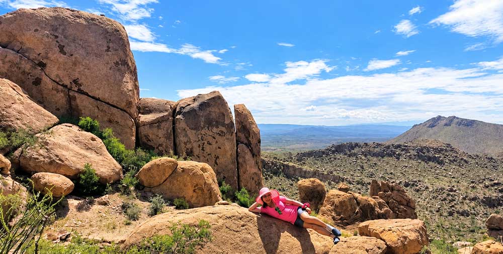
Stay inside Big Bend if you can. It cuts down on driving and puts you closer to the areas in this itinerary.
We camped at both Rio Grande Village and Chisos Basin, and staying inside the park made a big difference when we were already covering long distances during the day.
Staying Inside Big Bend
If camping is your style, staying inside the park is the way to go. We started at Rio Grande Village, then moved to Chisos Basin — waking up surrounded by mountains on all sides.
One thing to know: campground rules have changed since our trip. Big Bend’s developed NPS campgrounds now require reservations, so book your site ahead rather than counting on finding one open when you arrive.
Check Big Bend campsites and availability →
Staying Outside Big Bend
Prefer a hotel, cabin, or vacation rental? Terlingua and Study Butte are the first places I’d look.
Big Bend is too spread out to wing it — booking a base in Terlingua or Study Butte before you go means you’re not burning drive time between the park and your bed every night. It’s the practical choice: cabins and rentals that put you close enough to the park to maximize actual trip time, not commute time.
Find a Big Bend stay for your dates →
Big Bend Is Bigger Than It Looks on a Map
This is one of the biggest things my first trip taught me.
Big Bend isn’t a park where you finish one attraction and assume the next one is 10 minutes away.
There are more than 100 miles of paved roads and another 150 miles of dirt roads inside the park.
You need to think about driving time, gas, water and where you’re going next before setting off across it.
Day 1: Lost Mine Trail + Chisos Mountains
I’d dedicate the first day to the Chisos Mountains rather than immediately bouncing between different parts of Big Bend.
We eventually camped in Chisos Basin, and it was one of my favorite places to wake up during the trip.
Our campsite sat near the edge of the Basin with mountains surrounding us and a view toward the Window.
It felt completely different from Rio Grande Village.
Start Early on Lost Mine Trail
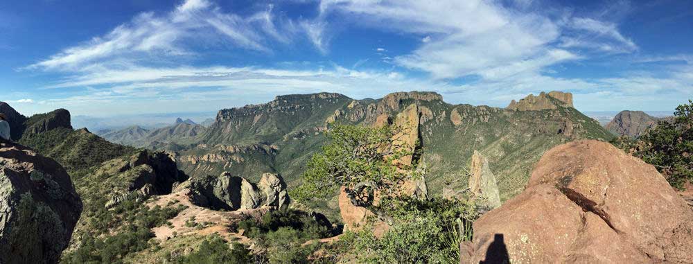
Lost Mine Trail deserves to be the main activity of the morning.
For us, this was the hike where Big Bend really opened up.
As we climbed, the views stretched farther across the mountains and desert. Reaching the top felt like something we’d worked for rather than another roadside stop we’d checked off.
I wouldn’t squeeze it between several other major attractions, especially in hot weather.
Start early, carry plenty of water and give yourself enough time that you aren’t racing the clock.
Afterward, keep the rest of the day around Chisos instead of immediately driving across the park.
Hiking Lost Mine? Read next:
[Lost Mine Trail: Difficulty, Time & What the Hike Is Really Like]
Day 2: Ross Maxwell Scenic Drive + Santa Elena Canyon
Santa Elena Canyon is the part of this 3-day itinerary where current conditions can completely change the plan.
We actually tried to get closer to Santa Elena Canyon on our trip.
But the water was waist-deep and muddy, and we weren’t comfortable continuing through it.
So we turned around.
We didn’t get the Santa Elena Canyon experience we had hoped for, but that attempt taught us something useful: don’t assume you’ll be able to follow your planned route just because a trail or canyon is on your itinerary.
Conditions around Big Bend can change after rain and flooding. Check the current road and trail status before making the drive, and once you’re there, use what you actually see in front of you to decide whether to continue.
What I’d Do at Santa Elena Canyon Next Time
I’d still include Santa Elena Canyon in a 3-day Big Bend itinerary.
I’d give the west side its own day, drive Ross Maxwell Scenic Drive and make Santa Elena the main destination—but I’d check conditions first and leave enough flexibility to turn around again if needed.
We already did it once.
There will always be another trip.
See Santa Elena Canyon From the Rio Grande
If you want to experience this side of Big Bend from the water, check the guided river trips running during your dates.
You can drive past canyon walls in Big Bend — or you can float beneath them. 118 miles of the Rio Grande run along the park, and a guided river trip gets you into canyons and stretches of the park you simply can’t reach by car or trail. Whether you want a short float or a full rafting or kayaking day, it’s the one way to see Big Bend from a completely different vantage point than everyone else on the park roads.
Day 3: Hot Springs + Boquillas + Boquillas Canyon
This is the part of our trip I would absolutely group together again.
The Hot Springs, Boquillas Port of Entry and Boquillas Canyon are all on the Rio Grande side of Big Bend.
In July, though, the order matters.
Go to the Hot Springs Early
We headed to the Hot Springs in the morning because we knew the day would get hot.
It got hot anyway.
We drove toward the Hot Springs Historic District. When the final stretch looked too narrow for our comfort, we parked and walked the rest.
Along the way, we passed remnants of the old settlement and rock art before reaching the Rio Grande.
Then we reached the spring.
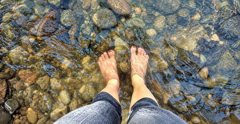
The water is about 105°F.
In July, soaking wasn’t particularly tempting.
We dipped our hands in instead.
If I returned during summer, I’d go even earlier—before the heat and other visitors start building.
Going to the springs? Read next:
[Big Bend Hot Springs: Trail, Soaking & What to Know Before You Go]
Cross Into Boquillas, Mexico
This was one of the most memorable experiences of our Big Bend trip.
We went through the official Boquillas Port of Entry and followed the instructions for crossing into Mexico.
From there, we walked toward the Rio Grande.
Then came our international ferry.
It was a tiny rowboat.
The crossing lasted barely any time at all, but suddenly we were standing in Mexico looking back toward Big Bend National Park.
On the Mexican side, we could continue toward the village on foot or take transportation.
It was July.
We took the truck.
Have Lunch in Boquillas del Carmen
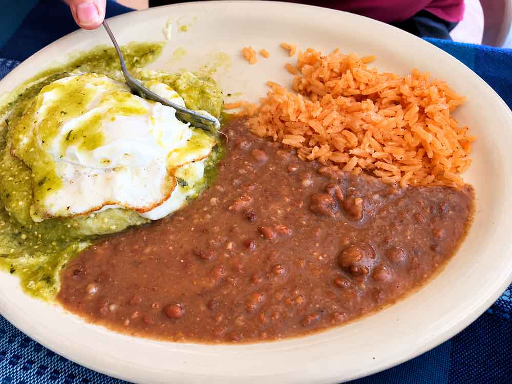
We ate at Jose Falcon’s overlooking the river and canyon.
There were cold drinks, food, a man playing guitar and a view that made it easy to sit there longer than expected.
Afterward, we walked around the village, passing brightly painted homes and local crafts.
What stayed with me wasn’t one particular attraction.
It was the contrast.
One moment we were inside a U.S. national park. A short rowboat ride later, we were eating lunch in a small Mexican village.
The crossing currently requires a valid passport book or passport card. As of September 2026, NPS lists the port as open Friday through Monday, 9 AM–4 PM, until further notice. Check again before your trip because the schedule can change.
Planning to cross? Read next:
[Boquillas, Mexico From Big Bend: How the Border Crossing Works]
Finish at Boquillas Canyon
After returning from Mexico, we headed to Boquillas Canyon.
This is where our July timing caught up with us.
The beginning of the hike was exposed and hot. The ground and canyon walls seemed to throw the heat right back at us.
We carried water and used whatever small patches of shade we could find.
Then we got deeper toward the canyon.
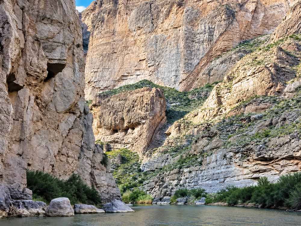
Sand appeared under our feet. The Rio Grande ran beside us. Huge canyon walls rose around the river.
The entire feeling of the hike changed.
Would I hike Boquillas Canyon again?
Absolutely.
Would I deliberately start it during one of the hottest parts of a July day again?
No.
That’s the kind of lesson trail mileage alone won’t tell you.
Hiking Boquillas Canyon? Read next:
[Boquillas Canyon Trail: What to Expect on the Hike]
The Big Bend Drive We Turned Around On
At Panther Junction, I saw a photo of Ernst Tinaja and immediately wanted to go.
Getting there meant taking Old Ore Road.
We had a truck, so we tried.
The farther we drove, the rougher and rockier the road became.
Then we reached a steep, deep section that made us stop.
We could keep going and hope everything worked out—or turn around while we knew the truck was fine.
We were miles into a remote park, and this was the vehicle we needed to drive home.
We turned around.
I still want to see Ernst Tinaja.
I also still think we made the right decision.
Explore Big Bend’s Backcountry
Big Bend’s primitive roads open up another side of the park, including destinations like Ernst Tinaja.
If those remote areas are high on your list, backcountry trips are available around Big Bend.
Current road note: Check current NPS conditions and permit requirements before planning any primitive-road route.
What I’d Do Differently With 3 Days in Big Bend
Our trip worked because we were flexible, not because we followed a perfectly optimized schedule.
We changed campgrounds. We extended the trip. We tried Old Ore Road and turned around. We crossed into Mexico. We hiked Boquillas Canyon when it was hotter than I would choose now.
The easiest way to make a Big Bend National Park itinerary work is to group each day by area instead of bouncing back and forth across the park. If I had exactly three days today, I’d make a few changes:
- Group each day geographically.
- Start summer hikes early.
- Fill up before the gas gauge becomes a problem.
- Download offline maps before entering the park.
- Carry plenty of water.
- Check road conditions before heading onto primitive roads.
- Leave room for the plan to change.
Big Bend gave us plenty of reasons to do exactly that.
Big Bend FAQ
Can You Get Gas Inside Big Bend?
Yes — at Panther Junction (24/7, credit card) and Rio Grande Village (store hours). Distances between stops are long, so top off whenever you can rather than waiting until you’re low.
What do you need to cross into Boquillas, Mexico?
A valid passport book or card. Crossing hours are limited and can change, so verify the current schedule with NPS before you build a day around it.
Can you visit Big Bend in July?
Yes, but the heat dictates the schedule — hike early, drive or rest during the hottest hours, and carry more water than you think you’ll need.
How many days do you need in Big Bend?
Three days covers the park’s three main areas without rushing. Two days works if you prioritize; four adds welcome flexibility.
Is Big Bend National Park worth the drive?
Yes — the scale of the park doesn’t come across on a map, and even a few days leave you knowing there’s much more left unseen. Don’t try to conquer Big Bend in three days. Give yourself three days to experience it.
Ready to Plan Your Big Bend Trip?
Once you know how you’ll divide your days, book your stay next. Where you sleep affects how much driving you’ll do every morning and evening.
Find Big Bend hotels, cabins and stays for your dates ↓
Then keep planning:
Boquillas, Mexico From Big Bend: How the Border Crossing Works
Lost Mine Trail: Difficulty, Time & What the Hike Is Really Like
Big Bend Hot Springs: What to Know Before You Go