
Santa Elena Canyon Trail: Hike & What to Expect
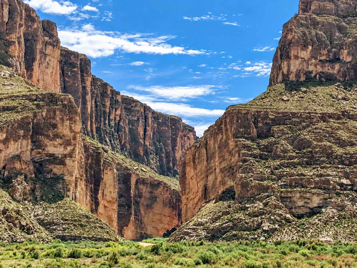
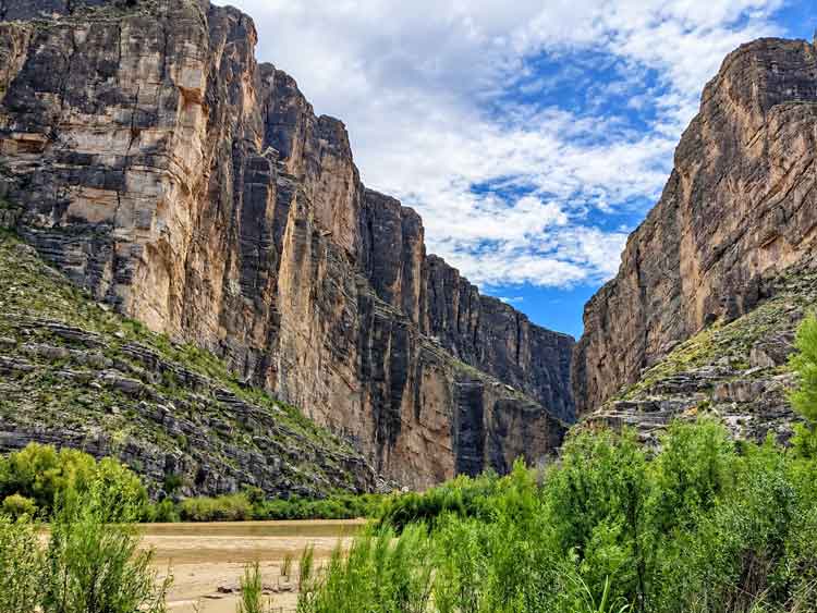
Santa Elena Canyon is one of the signature landscapes of Big Bend National Park, and the short trail lets you do more than see it from the outside. The hike crosses Terlingua Creek, climbs above the Rio Grande and then descends into the canyon, where the river runs between walls reaching roughly 1,500 feet high.
At 1.6 miles round trip, it’s also easy to combine with the stops along Ross Maxwell Scenic Drive rather than dedicating an entire day to one hike.
This guide covers what the trail is like, what to know before hiking it, and how to fit the canyon into your Big Bend itinerary.
Quick Answer: Is Santa Elena Canyon Worth Visiting?
Yes. Santa Elena Canyon is worth including on a first trip to Big Bend, especially if you’re already exploring Ross Maxwell Scenic Drive.
The 1.6-mile round-trip trail goes beyond the exterior canyon view by taking you across Terlingua Creek, up a short climb, and eventually down beside the Rio Grande inside the canyon. NPS lists about 80 feet of elevation change and one hour of average hiking time.
You don’t have to complete a long backcountry hike to experience the scale of Santa Elena, which is one reason it fits so naturally into a Big Bend itinerary.
What's In This Article?
Disclaimer: This post contains affiliate links. They don’t cost you anything, but they help keep SheRoamsMiles running.
Santa Elena Canyon Trail at a Glance
Good to know: Terlingua Creek conditions can change after rain. Check current trail and road conditions before heading to Santa Elena Canyon.
Why Visit Santa Elena Canyon?
The trail lets you experience the scale of Santa Elena Canyon from both outside and inside the canyon.
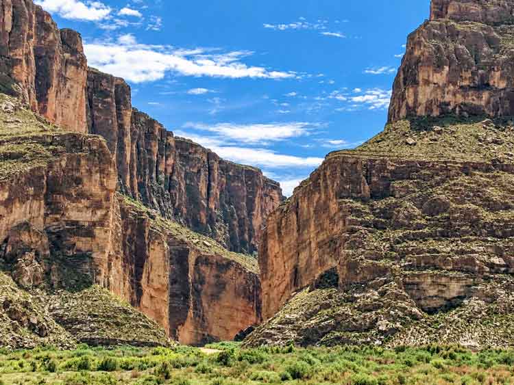
From the desert, you see an enormous opening cutting through the mountains. On the trail, that perspective changes as you climb above the Rio Grande and eventually descend to river level between the canyon walls.
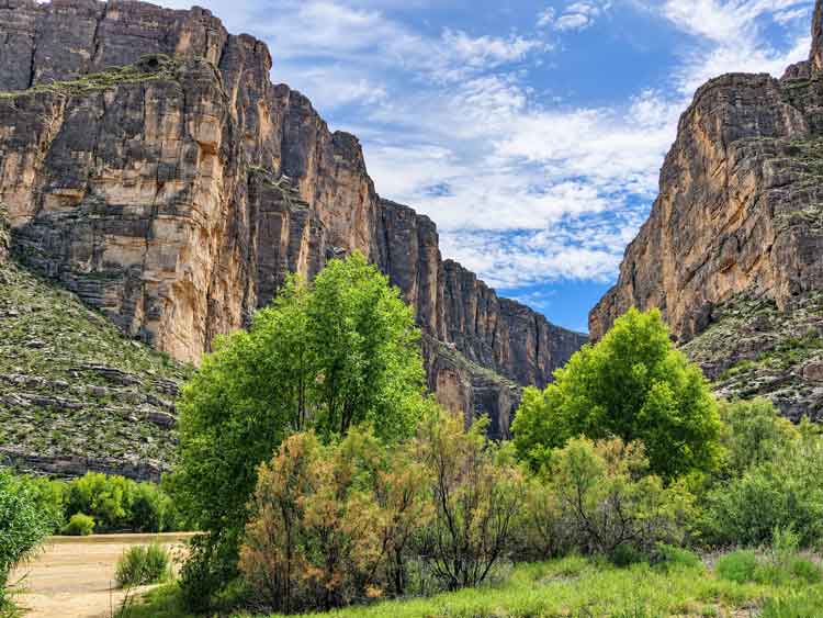
Santa Elena Canyon extends for about seven miles, with cliffs reaching approximately 1,500 feet high. The Rio Grande also forms the international boundary here, putting the United States and Mexico on opposite sides of the river.
The canyon’s scale — not a long list of separate attractions — is the reason to come.
Getting to Santa Elena Canyon
Santa Elena Canyon Trail begins at the end of Ross Maxwell Scenic Drive on the western side of Big Bend National Park.
If you’re coming from another part of this enormous park, don’t look at Santa Elena’s one-hour hiking time and assume it’s only a one-hour activity — the drive needs to be part of the plan.
We approached from the Chisos Basin side. There was water across some of the low dips in the road, and a road closure required us to change our route — worth checking current conditions before you leave rather than relying entirely on the route you mapped out ahead of time.
Recent flash-flood damage is affecting access around Santa Elena Canyon. The paved road between Cottonwood Campground and Santa Elena Canyon and Old Maverick Road are currently closed until further notice.
Check current Big Bend road and trail conditions →What Is the Santa Elena Canyon Trail Like?
The trail packs several distinct environments into 1.6 miles: a creek crossing, short climb, elevated viewpoint, descent to the Rio Grande, and a walk inside the canyon. Between the Terlingua Creek crossing, a short, steep bank, a stretch of concrete steps, and uneven terrain around boulders near the river, this is the list of physical features that shapes everything else about the hike — worth remembering, since it comes up again below.
Crossing Terlingua Creek
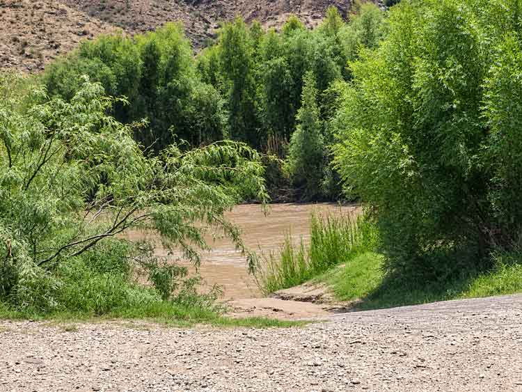
The trail starts by crossing Terlingua Creek. Conditions change with rainfall — NPS says the creek bed may be dry sand, thick mud, or flowing water. Once across, the maintained route climbs the short, steep bank.
Climbing Above the Rio Grande
After the creek crossing, the trail climbs a series of concrete steps to a higher viewpoint. This concentrated climb helps explain why NPS rates the trail moderate despite its short distance and relatively small total elevation change. From there, the route gradually descends toward the Rio Grande.
Walking Beside the Rio Grande
Once the trail reaches river level, the canyon walls become the dominant part of the experience. The route winds between large boulders beside the Rio Grande as it continues farther into the canyon.
The Rio Grande was muddy brown when we visited, rather than the blue-green water sometimes shown in Santa Elena photos. River appearance varies with conditions, but the color wasn’t what made the view — the scale of the canyon walls above the river was.
Where Does the Trail End?
The maintained trail continues beside the Rio Grande until the canyon wall meets the river and blocks further travel on foot. There’s no summit or major constructed destination at the turnaround — going into the canyon is the experience. From there, return to the trailhead along the same route.
How Difficult Is the Santa Elena Canyon Trail?
Santa Elena Canyon Trail is short but isn’t completely flat. NPS rates it moderate — for most visitors, the physical features above (the creek crossing, the steep bank, the concrete steps) are more useful for judging whether the trail fits their ability than the 1.6-mile distance alone.
Can Kids Hike Santa Elena Canyon?
For families, we’d evaluate the trail itself rather than making the decision from the distance alone. The same features that make this moderate rather than easy — the creek crossing, the steep bank, the steps, the uneven ground near the river — are what to weigh against your kids’ ability, not the mileage.
What to Know Before Hiking Santa Elena Canyon
Terlingua Creek is the part of this trail most likely to change from one visit to another.
Recent rain can leave the crossing dry, muddy, or filled with flowing water. NPS advises hikers to assess conditions before crossing and not cross if the water is deep and swift. Don’t try to bypass a difficult crossing by wandering far upstream looking for another way across — NPS specifically warns those routes can lead hikers into dangerous cliff areas outside the maintained trail.
For the hike itself, bring water, sun protection, and shoes suitable for the conditions. NPS recommends old shoes when the creek crossing is muddy and emphasizes carrying plenty of water in Big Bend’s hot, dry climate.
Should You Hike Santa Elena Canyon or Just See It From Outside?
If trail conditions allow and the hike fits your ability, we’d go beyond the exterior view and do the trail.
The outside perspective shows the canyon’s enormous opening through the mountains. The trail gives you something different: you move from looking at Santa Elena Canyon to standing beside the Rio Grande inside it. Because the hike averages about an hour, it fits naturally into a Ross Maxwell Scenic Drive day without becoming the only thing you accomplish.
If Terlingua Creek isn’t safely crossable, the canyon itself is still worth seeing from outside.
Can You Kayak or Raft Through Santa Elena Canyon?
Yes. A river trip provides an entirely different way to experience Santa Elena Canyon.
NPS describes Santa Elena as a popular Rio Grande river trip, with canyon walls reaching about 1,500 feet. Longer routes can involve technical water depending on river flow. There’s also a shorter option called a boomerang trip: paddlers travel upstream from the Santa Elena Canyon Trailhead for a few miles and then return downstream.
A backcountry use permit is required for river trips, including day-use watercraft trips; NPS says no fee is charged for day-use river permits.
A guided river trip provides a different perspective from the hiking trail, putting you on the water looking up at the canyon walls.
How to Fit Santa Elena Canyon Into Your Big Bend Itinerary
Plan Santa Elena Canyon as part of your western Big Bend day rather than treating the 1.6-mile trail as an isolated destination.
The trailhead is at the end of Ross Maxwell Scenic Drive, so the canyon naturally works as the anchor for a day exploring this side of the park. This also helps with one of Big Bend’s biggest planning realities: the park is huge. Grouping sights geographically reduces unnecessary driving and gives you more time at the places you actually came to see.
Where to Stay for Santa Elena Canyon
If Santa Elena Canyon and Ross Maxwell Scenic Drive are priorities, location matters because of Big Bend’s driving distances.
For an outside-the-park base on the western side, compare accommodations around Terlingua and Study Butte based on their location relative to the parts of the park you plan to explore — not nightly rate alone.
Is Santa Elena Canyon Worth Visiting?
Yes. We’d include Santa Elena Canyon on a first trip to Big Bend.
The exterior view shows its scale, while the short trail lets you move into the canyon and see the Rio Grande from between the walls. At 1.6 miles round trip, it also works well as part of a larger Ross Maxwell Scenic Drive day instead of consuming the entire day.
Our visit also reinforced something useful about Big Bend: what you see may not look exactly like the photographs you researched beforehand. The Rio Grande was muddy brown during our visit, yet the river color didn’t determine whether Santa Elena was worth seeing.
The canyon itself was the reason to be there.
NEXT STEP
→ Plan the Rest of Your Trip With Our Big Bend National Park Itinerary
Exploring the Rio Grande side too? Read our Big Bend Hot Springs guide.


I would love to walk through that canyon. Beautiful shots.
Thank you for joining the Wordless Wednesday Blog Hop.
Have a fabulous Wordless Wednesday. ♥
Thank you Sandee.. You as well..